
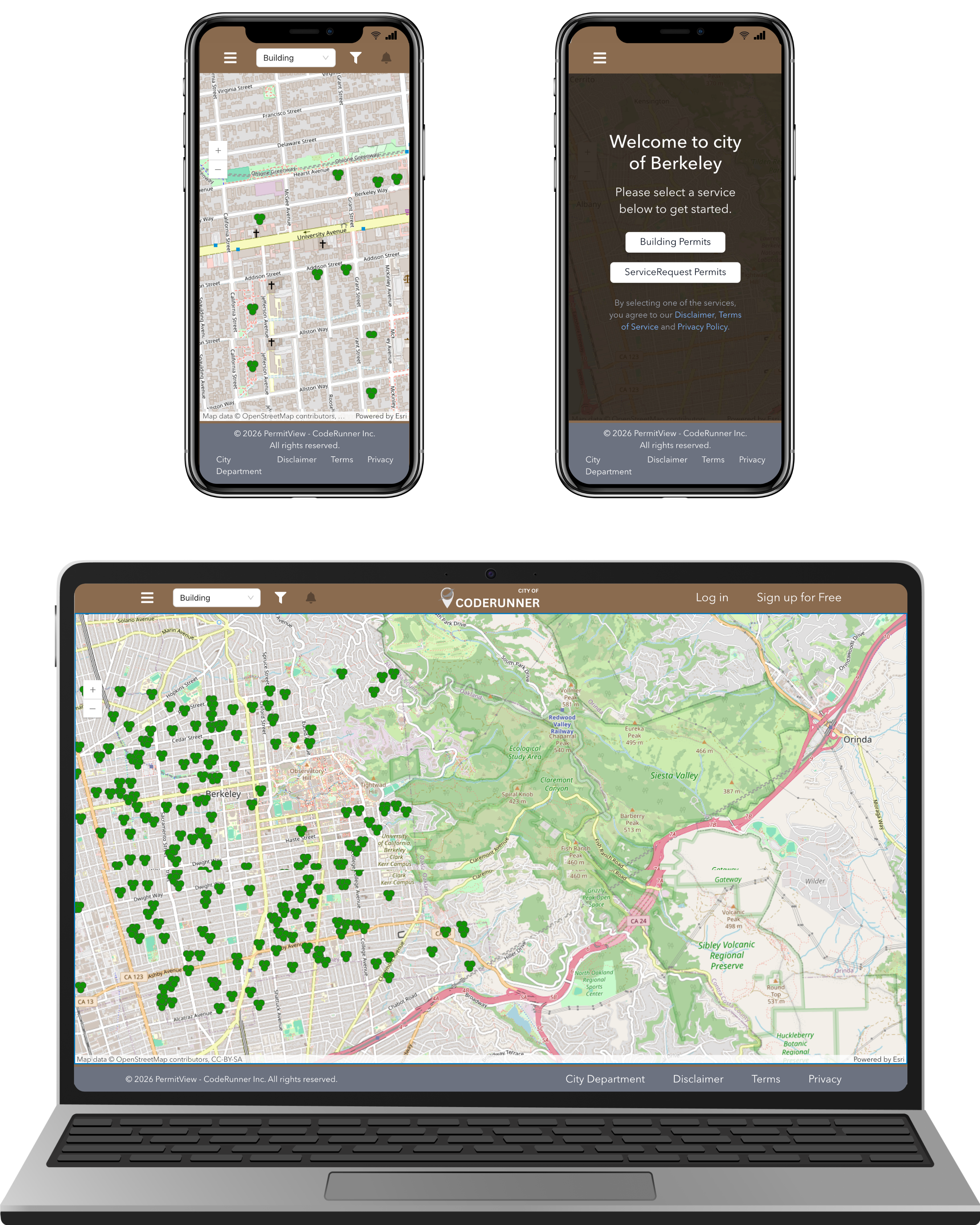
A public-facing permit map that connects directly to your permitting system
PermitView creates branded permit portals with filters, location-based alerts, and a visual experience for public transparency — built to sit on top of Accela and other permitting platforms.
Permit processes weren’t built for residents — and cities feel the impact
Public information is technically available — but buried in legacy portals, slow searches, and multi-step lookup flows. The result? phone calls, confusion, delays, and heavy staff workload.
The average city spends 15–30% of counter time responding to basic permit status calls.
Residents jump between multiple portals to find records or check status.
No map or spatial view showing where activity is clustering.
Slow platforms force residents to call staff — costing hours each week.
Permit data is public — but hard to interpret and compare at a glance.
The solution
PermitView introduces a clean, city-branded transparency layer — a modern map + search portal that connects to your permitting system and makes information easy to find, filter, and trust.
Key benefits
Faster access, reduced staff workload, and better visibility across applications and neighborhood activity.
Citizens and staff view permit information quickly — from any device — without digging through legacy portals.
Reduce staff workload by simplifying how the public obtains answers to basic status questions.
A visual layer supports faster intervention where application volume is rising or delays are emerging.
Sync with permitting systems via API or scheduled workflows — minimal IT lift required.
Competitive advantage
One platform for transparency, permit search, filtering, and alerts — designed for fast rollout and ease of use.
- Interactive map experience
- Geospatial alerts & subscriptions
- Simple UI focused on public users
- Mobile-first design
Integrations
Centralized access to permit data across platforms — whether through direct API, scheduled sync, or link-through model.
Link out to records or ingest via integration.
Bring permits into one consistent mapped view.
Enable a better public browsing experience.
Flexible ingestion options & data workflows.
Preferred when the permitting platform has stable endpoints.
Scheduled sync for status, attachments, and updates.
The map serves as a front-end view — users click through for full records.
FAQ
Is this public facing or internal only?
Either — we support public portals for transparency, internal restricted dashboards for staff, or a hybrid model.
Do we need to replace Accela or our current system?
No — PermitView sits on top of your existing system and provides a faster map-driven experience.
How does a user see full permit details?
Users click an object on the map, view a preview, and open the full record in your permitting portal.
Can this be customized per city?
Yes — each deployment can be branded with your identity, configured to your permit types, and optionally restricted by account login.
Demo & questions
Tell us your city and permitting system — we will send a tailored walkthrough and next steps.
- 📞 +1 (925) 871 9074
- 📍 3515 Mt. Diablo Blvd, Unit #27, Lafayette, CA 94549, USA
- ✉️ sales@coderunner.solutions