
OrbixViewer: Visualize, Analyze & Assign With Precision
The supervisor platform built for utility organizations — upload survey & AMLD data, analyze with spatial filters, and assign tasks directly to field crews.
Learn MoreThe Challenge Facing Utility Operations
Utility organizations handle massive amounts of survey and AMLD (Advanced Mobile Leak Detection) data — but most lack a modern system to visualize, analyze, and act on it efficiently.
Without a unified platform, supervisors struggle with disconnected tools, high licensing costs, manual task assignment, and limited insight into field progress.

Orbix: A Unified Platform for Utility Field Operations
Orbix connects administrators, supervisors, and field workers in one streamlined ecosystem — reducing costs, improving data transparency, and simplifying every stage of utility workflows.
Orbix Admin
- Upload survey & AMLD datasets
- Download or delete survey files
- Manage supervisors & workers
- Configure work order assignments
Orbix Viewer
- Visualize geospatial utility data
- Filter & analyze attributes
- Assign tasks directly on the map
- Track job progress in real time
Orbix Connect
- Receive assigned tasks instantly
- Navigate to task locations
- Attach images & add notes
- Update task status from the field
Why Orbix?
Utility teams lose countless hours fighting disconnected tools, manual task assignments, and expensive software that doesn’t scale. Orbix replaces that chaos with a unified, transparent, cost-effective system built for real-world field operations.
- ❌ Scattered tools → ✅ One connected platform for admins, supervisors, and workers
- ❌ High licensing fees → ✅ Open-source foundation that keeps costs low and data ownership in your hands
- ❌ Manual task assignment → ✅ Map-based dispatching that sends work instantly to the right field crew
- ❌ No visibility into progress → ✅ Real-time updates from the field with notes, images, and live status
- ❌ Slow decisions → ✅ Analyze survey & AMLD data faster with powerful geographic and attribute filters
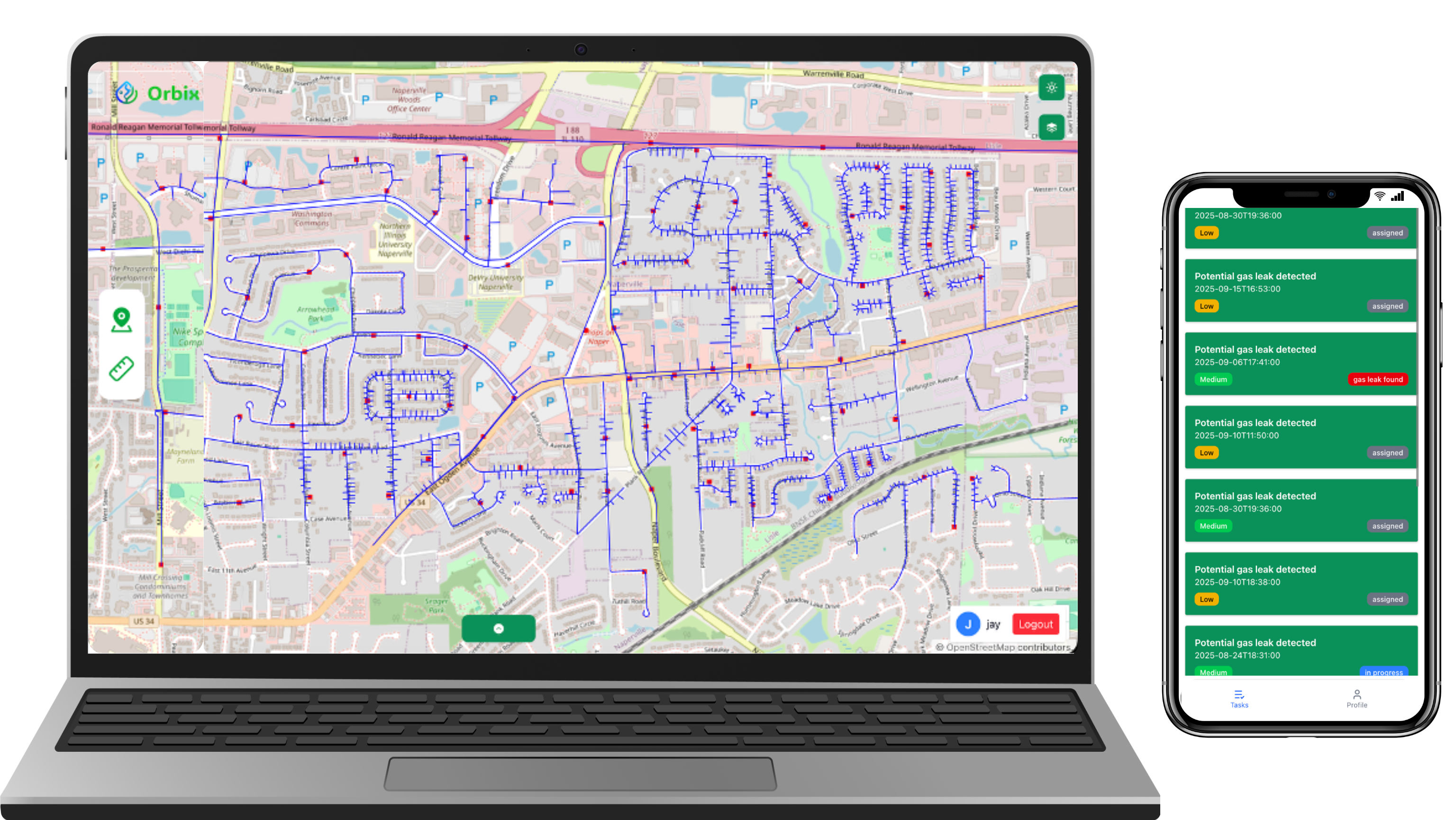
Built for Supervisors
Visualize Utility Data. Assign Work Instantly.
OrbixViewer gives supervisors complete oversight of survey and AMLD data in a powerful, map-based interface — making it easy to analyze, plan, and coordinate field operations.
- Interactive map visualization of all utility datasets
- Attribute filters and geographic selections for detailed analysis
- Assign work to field crews directly from the map
- Live progress updates as workers change task status
- Search, filter, and sort tasks by type, priority, or location
Book Your Free Demo
Experience how Orbix streamlines utility operations with real-time data visibility, smarter task assignment, and seamless coordination between supervisors and field crews.
Get a Free DemoNo credit card required. Takes 30 seconds to book.